Citymapper might not be preinstalled on Android phones like Google Maps, but it’s an excellent alternative to Google’s flagship mapping app. It provides the information you need to navigate cities, from public transport to safe walking directions. While it shares many of Google Maps’ best features, it’s a unique application that may serve you better.
This guide breaks down the similarities and differences of both apps so that you can decide which one is best for you. Citymapper is available on the same platforms as Google Maps, including WearOS smartwatches, so you can navigate without your phone.
Google Maps vs. Citymapper: Availability
Before downloading and experimenting with Citymapper, check if it’s available in your city. While Google Maps offers worldwide coverage to varying degrees of accuracy, Citymapper focuses on quality, not quantity.
Citymapper is available in 107 cities worldwide. Europe has the biggest share, with 71 cities covered by Citymapper, and the US has 27. Citymapper covers nine other cities in the rest of the world. You can see a complete list of supported cities on the Citymapper website.
Citymapper used to lock some features behind a paywall. These features are now free to use. Paying for a subscription only removes ads.
Google Maps vs. Citymapper: Navigation
Google Maps and Citymapper offer different navigation experiences. To help you compare the apps by your preferred travel method, we divided their navigation tools into three categories: driving, public transport (including taxis, e-bikes, and ridesharing), and walking and cycling.
Related
Google Maps vs. Waze
Which navigation app is better for you?
Driving
Google Maps easily wins here as Citymapper does not offer driving directions. If you need a navigation app for driving directions, consider Waze, Google’s dedicated driving app. However, Citymapper shows traffic volume, so you can check how busy the streets are before you set out.
Public Transport
While Citymapper doesn’t offer driving directions, it has fantastic support for local public transport options. Entering a start and end point in the app displays a detailed breakdown of every option you have to get from A to B, including pricing, estimated time, and later times for the same services. Along the bottom of the screen, you can filter the results by common factors like speed or with valuable tips like options with the least walking (perfect for rainy weather). You can compare buses, trams, trains, and more with one glance.
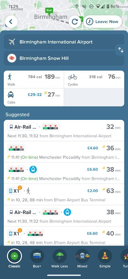
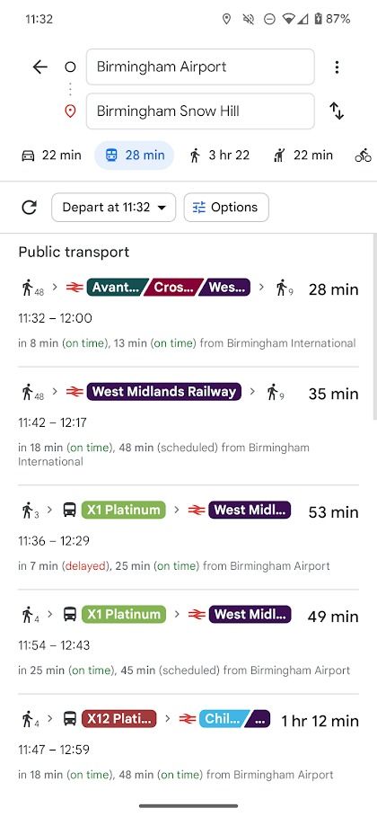
While you can find the same information in Google Maps, it’s less intuitive. It shows fewer public transport options, and comparing them means flipping back and forth between screens.
Citymapper’s strengths become more apparent when you use public transport. It tells you the number of stops between you and your destination and updates your estimated arrival time in real time. It also notifies you just before you need to get off.
We used Citymapper alongside Google Maps and found that Citymapper has more up-to-date information than Google Maps. Citymapper is usually the first to pick up roadworks, delays, relocated stops, and canceled trains.
Walking and cycling
Entering walking or cycling directions into Google Maps and Citymapper results in similar directions and estimated times, at least on the surface. However, key differences make Citymapper the better app for these directions.
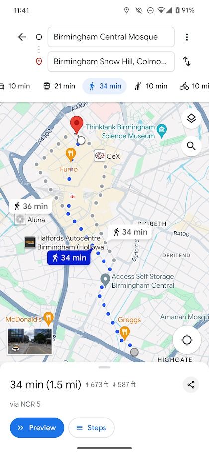
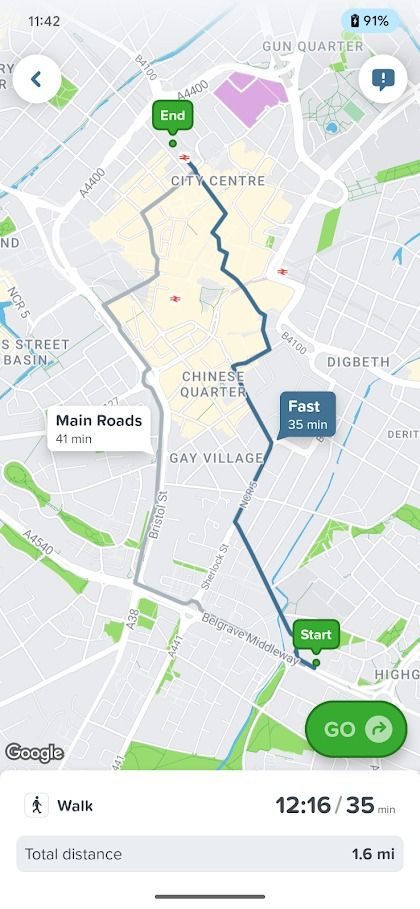
Citymapper offers a brilliant feature for its walking directions, which are absent on Google Maps. Tapping the Main Roads option routes you along main roads, perfect when you’re walking at night and want to stick to brightly lit streets. Beyond this, Citymapper tends to offer more accurate directions, but not significantly more so than Google Maps.
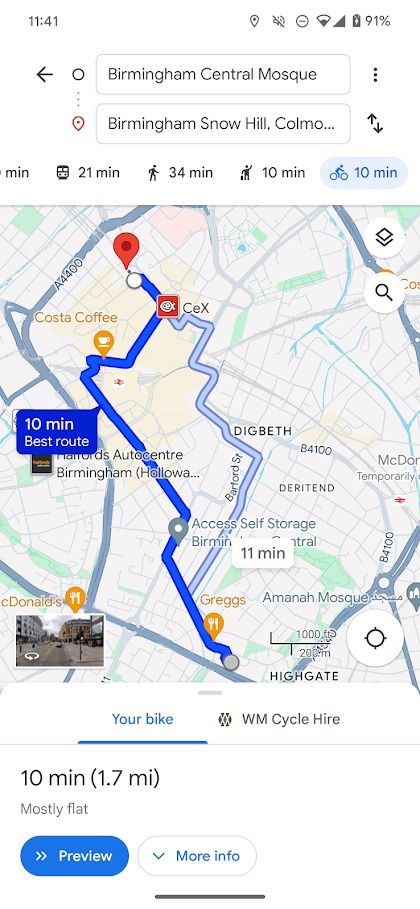
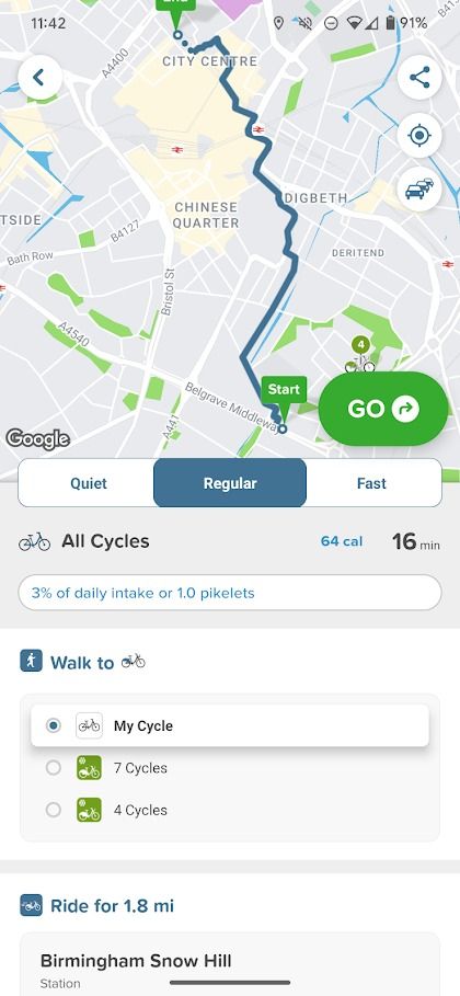
Cycling options are more comprehensive on Citymapper. It offers three route options (Quiet, Regular, and Fast) and shows locations, estimated walking times, and city bike rentals. Google Maps also shows bike rentals but with fewer options.
Google Maps vs. Citymapper: Location information
Google Maps’ comprehensive approach means you can search for places to eat, check reviews, check the menu, find directions, and be on your way in minutes. Citymapper only offers directions. You can’t see any information about the place you’re going to, even opening times.
If you want to research your destination, Google Maps or another app like Yelp should be your go-to. Citymapper falls short in this area. It’s easy to set your destination without realizing that opening times have changed.
Google Maps vs. Citymapper: Useful features
Each app has unique features that help you navigate from A to B. While we can’t list everything, here are the most notable unique features of each app we haven’t already discussed:
Citymapper
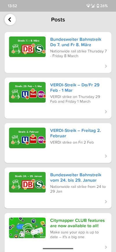
Check transport news (for example, strikes). Check the battery level of e-scooters and bikes. See a detailed breakdown of your travel data. Access digital versions of official maps.
Google Maps
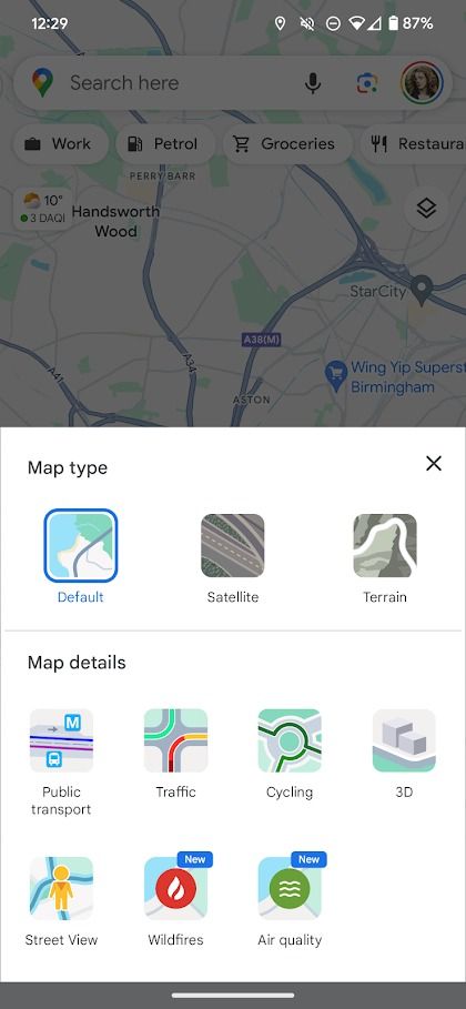
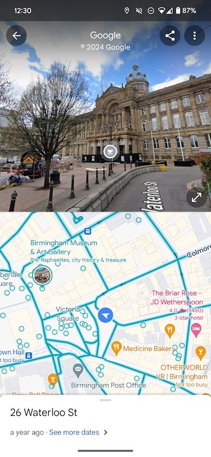
Lots of views, including satellite imagery. Street view. Timeline shows a detailed view of your past travels.
Choose the app that’s best for you
While Citymapper’s focus on public transport means it’s not a comprehensive solution for traveling like Google Maps, it offers more accurate and extensive support for public transport. If you’re ready to give it a shot, try these essential tips and tricks to use the best features of Citymapper.